
Skip to content

2026 How to Choose a Police Drone Detector?

Choosing a Police Drone Detector in 2026 requires more than comparing detection ranges.
A reliable system must identify genuine drone activity near stations, prisons, airports, and public events.
It should also reduce false alarms from birds, helicopters, weather, and nearby construction equipment.

Dr. Todd Humphreys, a respected drone-security researcher, has described a drone as “a flying computer with wings.”
That observation matters when evaluating modern detection technology.
A capable Police Drone Detector may combine radio-frequency monitoring, radar, optical cameras, and acoustic sensors.
Each method has strengths.
None is perfect.

In practical testing, officers should examine detection distance, sensor coverage, alert speed, and performance in rain or crowded urban areas.
A clear dashboard matters.
So does secure data handling.
The system should preserve timestamps, signal details, and camera evidence without creating unnecessary privacy risks.
Buyers must also confirm training requirements, maintenance costs, software updates, and compatibility with existing communication systems.

Experience in the field can reveal weaknesses that brochures hide.
A detector may perform well over open ground but struggle beside concrete buildings.
It may recognize a common model quickly, then miss an unfamiliar design.
That is where careful trials become essential.
Do not trust one impressive demonstration.

The best choice supports lawful monitoring, responsible reporting, and measured human decisions.
Detection is not the same as identification.
It is not proof of intent.
This guide explains how to compare a Police Drone Detector by evidence, reliability, and operational fit.
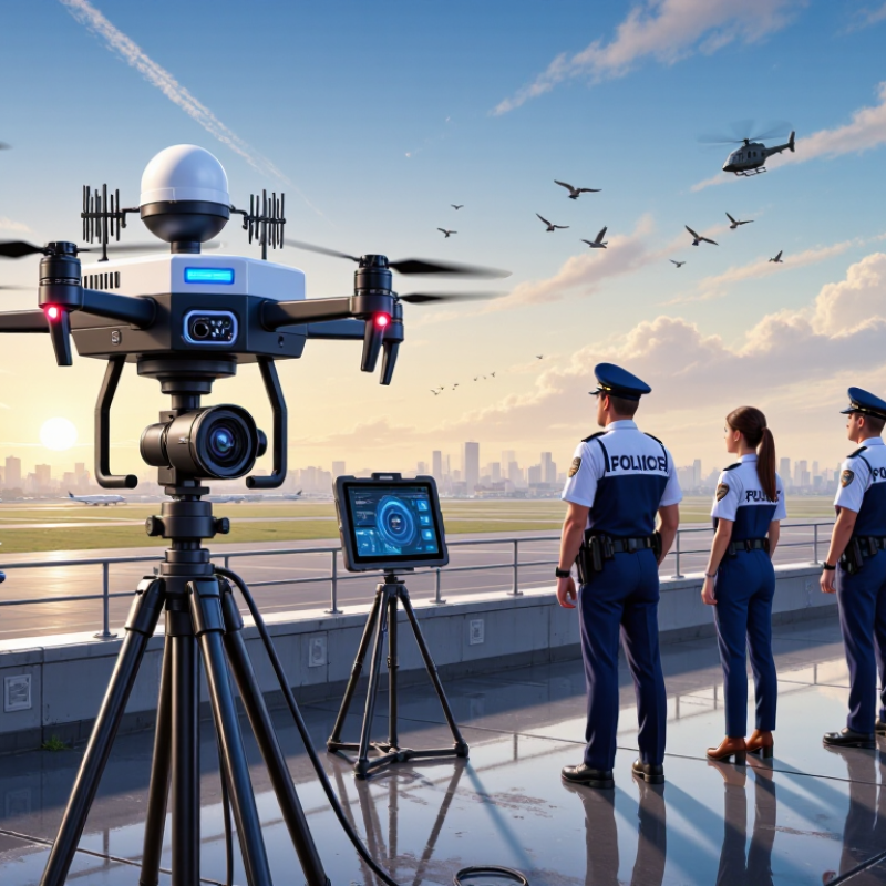
2026 How to Choose a Police Drone Detector?

Define the Police Mission: Detect, Identify, Track, or Mitigate

2026 How to Choose a Police Drone Detector?

Define the Police Mission: Detect, Identify, Track, or Mitigate

A police drone detector should match the mission, not merely display impressive technical data. Detection means discovering an aerial signal or object near a protected area. This requires dependable coverage, clear alerts, and performance during rain, traffic, and crowded radio environments.

An operator may need to know only that activity exists. That decision saves time.

Identification

Identification requires more evidence. The system should help distinguish a drone from ordinary wireless equipment, birds, or aircraft. Useful tools may show signal characteristics, direction, approximate location, and confidence levels.

These results should support trained personnel, not replace them. Human review remains essential when conditions are uncertain.

Tracking

Tracking demands continuity. Officers need a stable timeline, mapped movement, and reliable time stamps for lawful incident records. Test the detector around buildings, trees, and changing weather. Laboratory claims can feel distant from a stadium entrance. Very distant.

Mitigation

Mitigation should mean an authorized, proportionate response, such as notifying personnel, securing an area, or coordinating with aviation authorities. Do not assume every alert justifies intervention.

Procurement teams should request field demonstrations, maintenance details, calibration procedures, data protection controls, and operator training. Ask how false alarms are recorded and corrected. That question matters.

No detector performs perfectly. A system that admits uncertainty may support better decisions than one that hides it.

Review local policies, permissions, and evidence requirements before deployment. Metrics should reflect the real mission: faster awareness, accurate identification, safer tracking, or clearer coordination.

Map RF Coverage Across Common 2.4 GHz and 5.8 GHz Drone Bands

Choosing a police drone detector starts with its RF coverage map, not its advertised range. The ITU Radio Regulations identify 2.400–2.4835 GHz and 5.725–5.875 GHz as widely used ISM ranges, although national allocations differ. These bands also carry Wi-Fi, industrial sensors, and other signals. A detector must separate drone-like control patterns from ordinary background traffic.

Map both bands on site. Mark rooftops, trees, concrete walls, patrol routes, and likely launch areas. Measure signal strength at ground level, building corners, parking areas, and elevated viewpoints. ITU-R Report SM.2256 recommends repeatable spectrum-monitoring methods, including calibrated antennas and location-based measurements. Use those principles. Do not trust a single reading. A 5.8 GHz signal may weaken sharply behind a wet tree, while 2.4 GHz may travel farther but suffer heavier congestion.

The FAA reported more than 800,000 registered civil drones in the United States during 2024, showing why dependable detection planning matters. Still, registration numbers do not predict local RF density. Create separate heat maps for 2.4 GHz and 5.8 GHz, then test during morning, evening, and major public events. Include false alarms from wireless networks. A quiet test day can mislead. The map should record frequency, signal level, antenna position, weather, and time. Operators should also verify privacy, spectrum-use, and evidence-handling requirements with qualified authorities. Some coverage gaps will remain. That is the uncomfortable part.

Use FAA Remote ID Requirements Effective Since September 2023

How to Choose a Police Drone Detector in 2026

The FAA Remote ID rule took effect on September 16, 2023. After a limited compliance period, operators generally needed approved Remote ID compliance. The FAA rule requires broadcast data, including drone identification, position, altitude, velocity, and control-station or takeoff location. Therefore, a useful detector should receive and decode these signals, rather than only detect radio noise. FAA’s 2024 Aerospace Forecast reports more than 850,000 registered drones in the United States. That scale makes identification quality more important than a simple alarm.

Choose equipment with multi-band reception, clear detection range testing, accurate time stamps, and exportable evidence logs. Ask whether it recognizes Standard Remote ID, broadcast modules, and approved exceptions such as FAA-recognized identification areas. The AUVSI Economic Impact Report projected significant growth in commercial drone operations, reinforcing the need for systems that can handle busy airspace. Still, Remote ID is not radar. It may miss compliant aircraft outside coverage, shielded signals, or aircraft operating under different approved methods. A perfect detector does not exist.

Tips: Test the system at your actual site. Measure results near buildings, trees, and reflective surfaces. Compare alerts with known flight records. Do not treat an identifier as proof of wrongdoing. Protect stored location data, limit access, and document calibration dates. I would also review false alarms monthly; this step is easy to neglect.

2026 How to Choose a Police Drone Detector? — Use FAA Remote ID Requirements Effective Since September 2023

FAA Remote ID requirements establish an important baseline for drone-detection equipment. A detector should be evaluated for its ability to receive, decode, time-stamp, and display compliant Remote ID broadcasts, while recognizing that the FAA rule does not prescribe a specific detector technology.

How to use this chart: The final rule was published in 2020, became effective in 2021, and reached its main compliance date on September 16, 2023. FAA enforcement discretion for aircraft and operators that could not yet comply ended on March 16, 2024. For police procurement, compare detector coverage, Remote ID message decoding, location accuracy, alert latency, logging, and performance in the intended operating environment.

Sources: U.S. Federal Register Remote Identification Final Rule; FAA Remote ID Guidance.

Compare RF, Radar, EO/IR, and Acoustic Detection Performance

Police drone detection should be selected by environment, not by a single headline range. The Federal Aviation Administration reported more than 860,000 registered drones in the United States in 2024. That growth increases the need for layered, evidence-based awareness around stations, events, and critical sites.

RF detection can identify control links quickly, often before visual contact. However, it may miss autonomous or radio-silent aircraft. Radar adds wider-area coverage and can track non-emitting targets, but buildings, birds, and rain create false alarms. A 2024 MarketsandMarkets report identified RF, radar, optical, and acoustic sensing as major counter-drone technology segments, reflecting this layered approach.

EO/IR cameras provide the strongest confirmation. They can show aircraft shape, direction, and payload details, yet darkness, fog, glare, and operator workload reduce consistency. Acoustic sensors are useful near quiet perimeters and can support rapid cueing. Urban traffic weakens them badly. NATO’s 2023 science and technology guidance emphasizes probability of detection, false-alarm rate, and sensor fusion rather than range alone. That matters in practice. A detector showing 5 kilometers is not automatically better. Test each system against small aircraft, rooftop clutter, wet weather, and night scenes. Data may look impressive on paper. Field performance can disappoint.

2026 How to Choose a Police Drone Detector? — Compare RF, Radar, EO/IR, and Acoustic Detection Performance

The comparison below summarizes typical field behavior of detection technologies. Actual performance depends on drone size, flight profile, radio emissions, terrain, altitude, weather, background noise, sensor placement, and system configuration. Figures marked as typical are indicative rather than guaranteed.

Evaluation Dimension RF Detection Radar Detection EO/IR Detection Acoustic Detection
Detection Principle Passively detects radio-frequency transmissions between a drone, controller, and related equipment. Transmits and receives electromagnetic waves to detect movement, range, bearing, and elevation. Uses visible-light cameras and/or thermal cameras to observe the drone or its heat signature. Uses microphone arrays and signal processing to identify sound patterns produced by propellers and motors.
Typical Detection Range Often from several hundred metres to several kilometres when the drone is actively transmitting; strongly dependent on frequency, transmit power, antenna height, and terrain. Commonly from several hundred metres to multiple kilometres for suitable targets; range depends on radar design, target radar cross-section, clutter, and line of sight. Usually from several hundred metres to over one kilometre for clear visual observation; thermal detection may extend useful coverage in darkness but varies by target and atmosphere. Typically tens to several hundred metres in quiet environments; range decreases substantially with wind, traffic, buildings, and other sound sources.
Best Detection Cue Control links, telemetry, video links, and other drone-related emissions. Physical motion and reflected energy from the aircraft, including some radio-silent targets. Visible shape, movement, thermal contrast, navigation lights, and operator-assisted image analysis. Acoustic signatures from rotating propellers and electric motors.
Detection of Radio-Silent or Autonomous Drones Limited
May not detect a drone that is not emitting a recognizable RF signal.
Strong
Can detect many physically moving targets without relying on a control-link signal.
Strong
Can observe a target when sufficient contrast, lighting, focus, and line of sight are available.
Moderate
May detect a radio-silent drone if its acoustic signature is above the background noise.
Target Identification Moderate
Can sometimes classify protocol, frequency, signal direction, or equipment type, but normally does not provide visual confirmation.
Moderate
Provides track characteristics such as range, speed, and bearing; classification improves with suitable software and sensor data.
Strong
Best option for visual confirmation, evidence collection, and distinguishing a drone from a bird when image quality is sufficient.
Limited
Usually provides a bearing and confidence estimate rather than a definitive visual identity.
Day/Night Performance High
Not dependent on daylight, although RF congestion can affect interpretation.
High
Operates in darkness, subject to weather, clutter, and system limitations.
Moderate
Visible cameras need adequate light; thermal cameras support darkness but can be affected by atmospheric conditions and low thermal contrast.
High
Works in darkness, provided the acoustic environment remains suitable.
Weather Sensitivity Generally low sensitivity to rain and darkness; terrain, foliage, electromagnetic interference, and antenna placement remain important. Rain, wet snow, sea clutter, wind-driven vegetation, and heavy precipitation can reduce tracking quality or increase clutter. Fog, rain, snow, dust, low contrast, glare, and thermal turbulence can reduce image quality and detection probability. Wind, rain, humidity, nearby machinery, traffic, and reflected sound can significantly reduce performance.
Urban Environment Moderate
Buildings can block signals, while dense RF activity can complicate classification and create false associations.
Moderate
Buildings, wires, trees, moving vehicles, and other fixed or moving objects create clutter.
Moderate
Buildings and vegetation obstruct line of sight; lighting and visual clutter can complicate classification.
Limited
Traffic, HVAC systems, construction, crowds, and building reflections often mask drone sound.
Typical False-Alarm Sources Wi-Fi devices, cellular equipment, video transmitters, control systems, and other emitters operating in nearby bands. Birds, vehicles, cranes, trees, buildings, weather effects, and other moving or reflective objects. Birds, insects, aircraft, balloons, lights, reflections, and moving objects with similar appearance. Birds, vehicles, fans, generators, construction tools, wind, and other rotating machinery.
Direction and Track Information Can provide bearing or geolocation estimates when multiple synchronized sensors or suitable antenna arrays are used. Typically provides range, bearing, altitude or elevation, speed, and continuous track information. Can provide line of sight and image-based tracking; accurate range and altitude usually require additional sensors or geometry. Usually provides an estimated bearing; range and altitude are less reliable without multiple synchronized arrays.
Deployment Characteristics Passive, relatively low power, and suitable for fixed, vehicle-mounted, or portable installations. Requires careful placement, calibration, spectrum management, and consideration of emissions, power, and site safety. Requires unobstructed fields of view, camera positioning, stabilization, and regular cleaning or maintenance. Can be compact and low power, but microphone placement and acoustic calibration are critical.
Key Strength Efficient early warning when a drone uses detectable communications, with useful information about emissions and direction. Broad physical-target awareness, including many drones that do not transmit control or video signals. Direct visual confirmation and the strongest evidence for operator review, incident documentation, and target classification. Low-cost, passive supplementary detection in quiet areas, especially when combined with other sensors.
Key Limitation Reduced effectiveness against autonomous, frequency-hopping, encrypted, low-power, or radio-silent drones; legal restrictions may apply to signal collection. Potentially higher cost, greater site-planning requirements, and susceptibility to clutter and small-target limitations. Requires line of sight and sufficient image quality; cannot reliably detect an obscured target behind buildings, trees, or terrain. Shorter practical range and high sensitivity to environmental noise, wind, and urban sound reflections.
Recommended Role in a Police Counter-UAS System Primary cue for passive RF awareness and early warning. Primary wide-area tracking sensor for non-cooperative or radio-silent targets. Verification, classification, evidentiary recording, and operator decision support. Supplementary detection layer for quiet sites and close-range confirmation.
Overall Suitability High when RF emissions are expected High for wide-area physical detection High for confirmation and identification Moderate as a supplementary sensor

Practical selection guidance: For police and public-safety deployments, a layered architecture is generally more reliable than relying on one sensor. RF can provide early warning, radar can maintain a track, EO/IR can confirm and document the target, and acoustic sensing can add short-range coverage where background noise is controlled.

Validate ASTM F3411 Data, False Alarms, Privacy, and FCC Compliance

How to Choose a Police Drone Detector in 2026

A credible detector should prove how it handles ASTM F3411 Remote ID data. Ask for test conditions, message types, update rates, and logs. Do not accept a simple “ASTM compliant” label. Compare received serial numbers, aircraft positions, pilot locations, and timestamps against a controlled reference flight. Check performance at different distances, heights, and weather conditions. Data gaps matter.

False alarms can waste attention quickly. Test the system near airports, rooftops, vehicles, Wi-Fi equipment, birds, and reflective structures. Request measured false-alarm rates, not attractive marketing percentages. Review how alerts are grouped and cleared. A useful interface shows confidence, signal source, time, and location. It should also explain uncertainty. No test is perfect. Real sites are messy.

Privacy deserves equal weight. Choose systems with limited collection, role-based access, encryption, and clear retention settings. Avoid unnecessary storage of pilot information. Request an audit trail and a documented deletion process. FCC compliance also requires careful verification. Confirm that the equipment has proper authorization for its intended operation and uses approved radio parameters. It should receive lawful signals without creating harmful interference. Ask for current technical records, not only a certificate image. A detector that performs well but lacks accountable records is not ready for responsible deployment.